
Wandsworth’s planning to make some improvements to the southern half of Queenstown Road – between its junction with Lavender Hill, and the big roundabout by Battersea Park. This scheme has been on the ‘we need to do something’ list for years – but following a Council agreement the plans are now likely to be consulted on, and depending on the money situation, they might actually move to construction at some point next year.
This isn’t some enormous construction project. It’s a bundle of fairly small changes that, taken together, should reduce the rather high number of accidents along the street, and make it a slightly better environment for people walking, cycling or driving along it – as well as some changes that will make it a better road to live or run a business on. We’ve taken a walk along the street, while piecing together what we know about the scheme – to see where the current problems are and what is being planned.
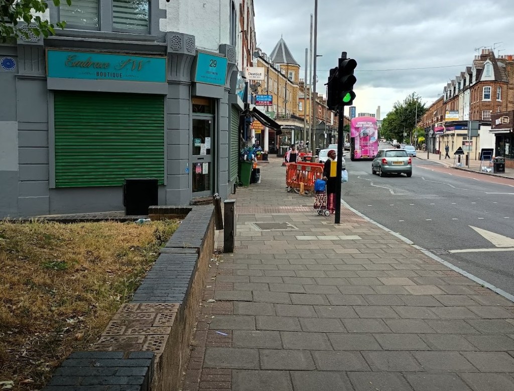
The first bit of plans will see changes at the Lavender Hill end – where an ‘improved public realm’ will be provided for the bit of Queenstown Road that is lined by shops. Hopefully as part of this we’ll see some changes made to drunks’ corner to fix the increasingly broken wall – and ideally also make it a bit less of a convenient hangout space for vagabonds and ne-er-do-wells who like to gather here and harass passers by and potential customers of the charity shop. Though this will need the housing and transport bits of the Council to work together (not always an easy thing!) as the green space is technically part of the estate.
One bit of helpful decluttering has already happened: the three old BT payphones that lined this bit of the road have already been removed, which was a good start as they hadn’t worked for years – and had become eyesores more used as unofficial toilets than to make calls.
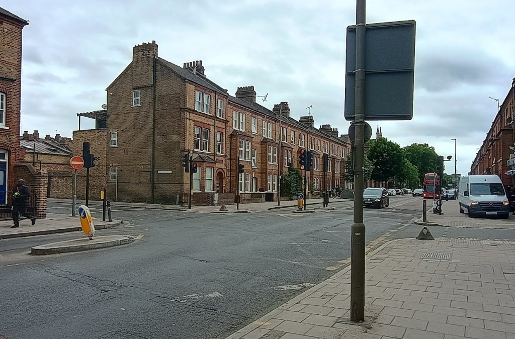
The next section, which has a series of shops and restaurants doing their best to attract custom – really not helped but the pavement in front being an absolute shambles that makes it look scruffy and uncared for. The plans here are focussed on an improved public realm – in essence, making this messy and always somewhat mucky bit of the road more attractive. They are expected to include ‘localised footway widening and introduction of inset parking’ – which hopefully means this rubbish bit of pavement can be completely replaced (including working with landowners so that new paving can run right up to the edge of the buildings, with demarcation studs used to avoid any tangles on which bits are privately owned) – while also creating a better defined inset parking spaces, adding a few street trees, and generally decluttering the space and creating something that works better for the traders here.

This is one of the worst-maintained bits of main road pavement in the Borough; you know it’s time for an upgrade when you can look across the Road and ever-shambolic Lambeth has something better looked after! There’ also an unhelpful tendency for this section to attract litter whenever there’s a strong wind. This part of the road is currently a real missed opportunity, and one of the key bits Wandsworth will hopefully really spend some time (and money) on – as getting the details right will turn a rather dilapidated street to somewhere much more attractive, and make a big difference to the whole local town centre.
The section of pavement in our photo below is also in the running for some kind of award, for having possibly the longest running pavement repair in Wandsworth, where the CCTV camera and street cabinets have been leaning precariously for over two years! Again we share the frustration of the traders here as this really isn’t the sort of environment for small businesses to thrive in.
The plans will see a cycle route created along the calmer side streets on either side of the Queenstown Diamond – Ingelow Road (for northbound cyclists) and St Philip Street (for southbound cyclists). In practice, this won’t mean much change really beyond some signs showing the route, and some minor works at the junctions. The really wide junctions already have raised crossings, but could usefully be narrowed a bit, with the corners built out further in to the roadway to make them safer to cross and control vehicle speeds a bit.
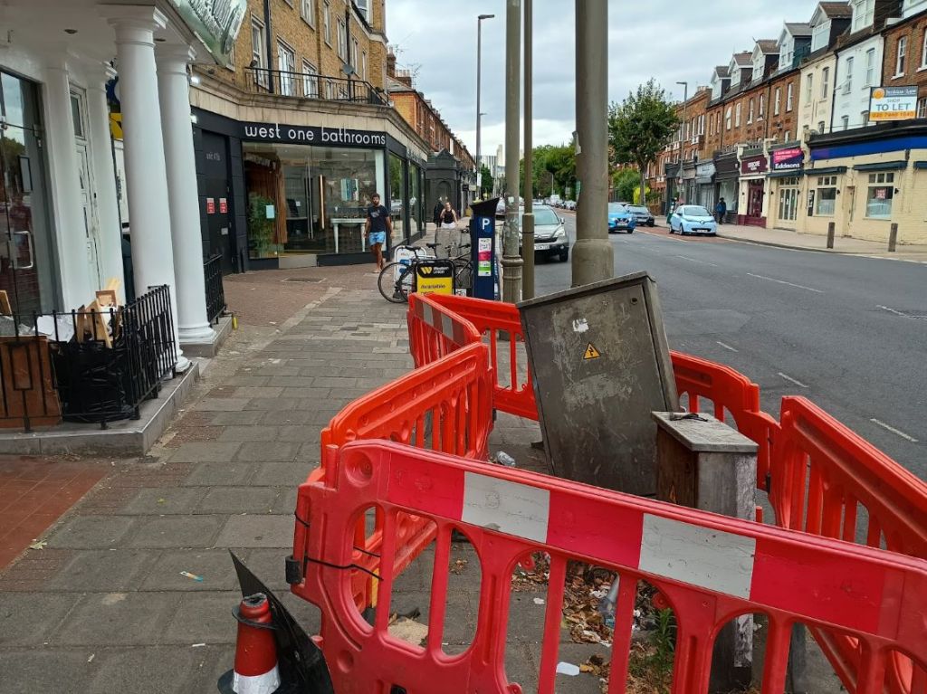
The stretch of pavement in front of West One bathrooms was, for some years, actively subsiding in to the ground – that has at least been sort of patched up in recent months, but this could again be improved with slight pavement widening to maintain a consistent road width, repaving the pavement with better quality materials, and some general public realm work to make it all look a bit less neglected.
There’s then a long straight section of Queenstown road where things are actually not too bad as things are. This area saw substantial improvement works in 2010, that moved the parked cars on to raised sections on the pavements (with the unusual side of effect of significantly reducing the width of the pavements). This addressed long standing concerns about the challenge of parking in the area by hugely increasing the amount of parking spaces available (as they were no longer clashing with the bus lanes), replacing awkward part-time bus lane parking spots that meant cycles had to veer out to the main traffic lane, with permanent 24-hour parking spaces that were separate to the bus lane.
The 2010 upgrade was well designed and has pretty much stood the test of time: the narrower pavements haven’t really been a problem in a stretch of street without many shops or businesses, and from a general safety perspective this part of the road actually works quite well. It’s also in rather better condition than the rest – so nothing is really planned to change on this part of the road. The main current concern on this bit of the road (which does reflect what we have seen) is that vehicle speeds tend to be quite a lot higher on this stretch with residents seeing many going well above the 20mph speed limit.
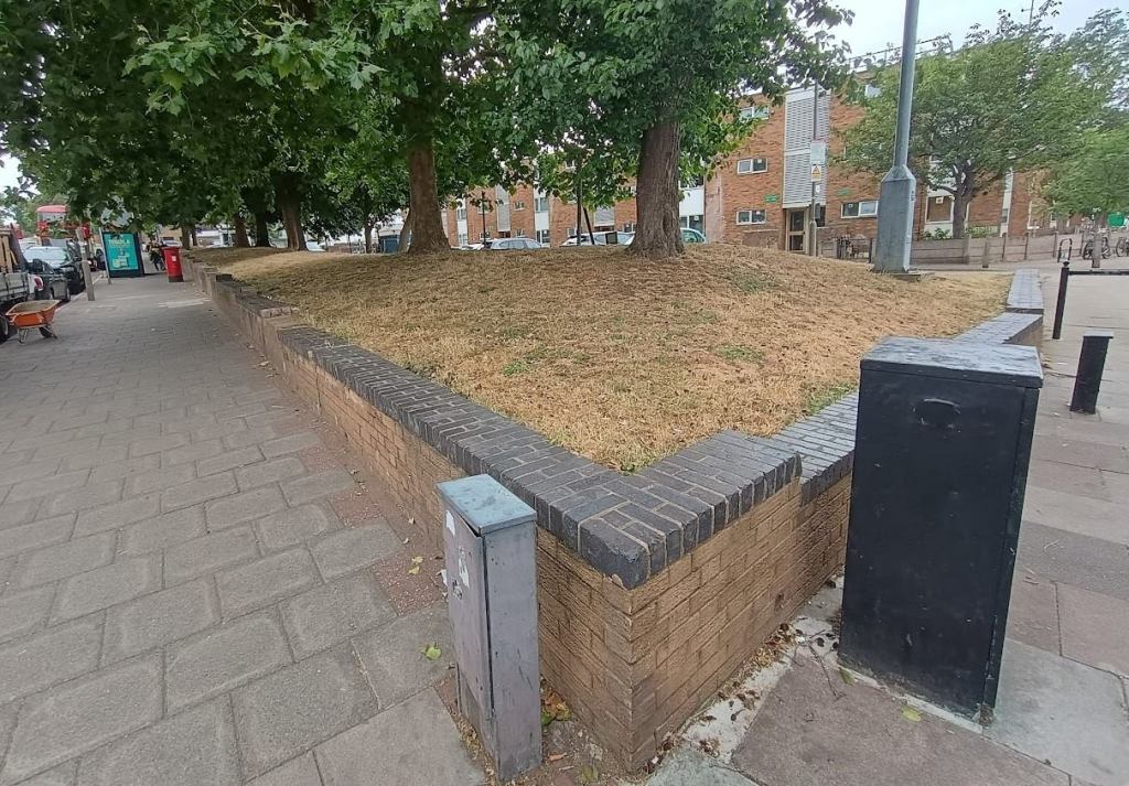
One thing that is suggested in the proposals is some scope for improvements to Queenstown Green, the small park half way along the street. This would be welcome, as the space – which is the result of a wartime bombsite that was never rebuilt – isn’t working especially well at the moment, and is a waste of the only green space in a large and dense area of flats. Maybe its biggest problem is that there’s not a lot in it other than grass, and the entire space is mainly used as a dog toilet – the sort where no one cleans up after their dog. If the area could be split in to two, with a dog-friendly area and a separately fenced no-dogs area, this would be an ideal space for a small playground aimed at younger children (as a complement to Lambeth’s Montefiore Gardens playground a few streets away), and generally make the park useful for people other than dog walkers.
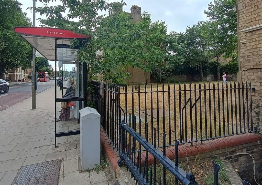
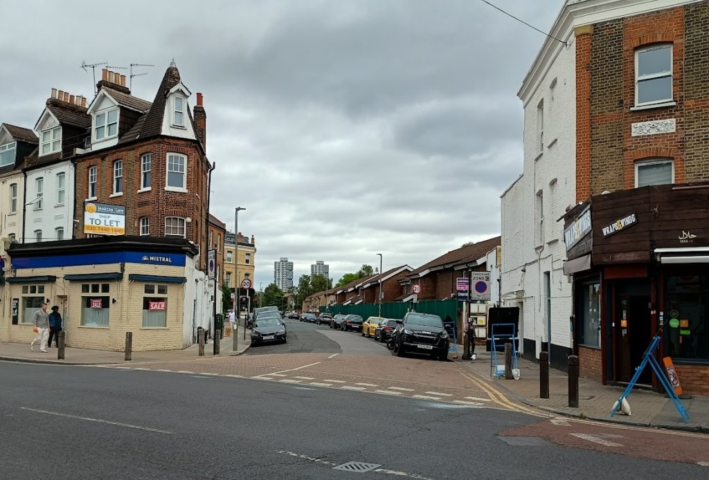
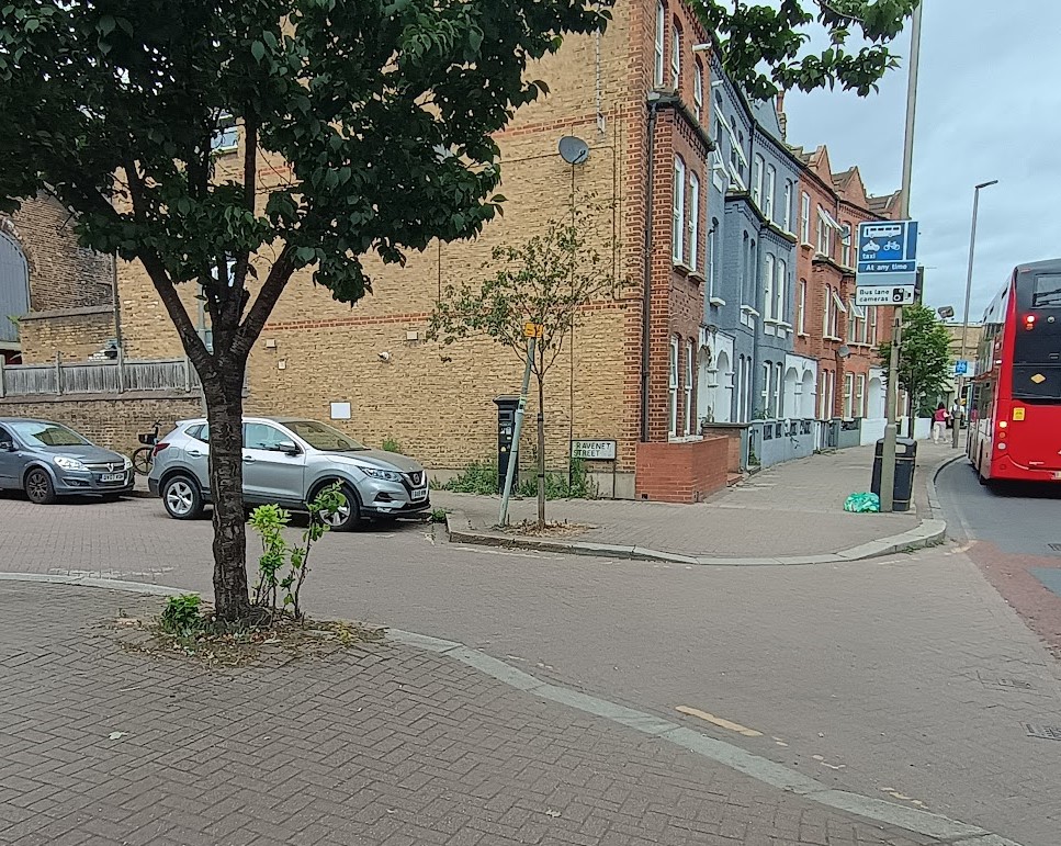
The junction with Broughton Street, shown below, will see very small tweaks, mainly to allow two-way cycling at the end of the street (which is currently a one-way street) for those wishing to go along the quieter backstreets.
The next section of Queenstown road is by far the worst bit from a safety perspective, with three successive junctions all identified as collision hot spots. The first is Silverthorne Road, with 9 collisions involving notable injury between 2018 and 2022. We’re not at all surprised at this one, the junction is too wide and the risk of cyclists, motorcycles and pedestrians getting cut up by large vehicles turning is really quite high. In our experience the large volume of concrete-batching-plant-related traffic and buses heading to the depot that use this junction drive pretty carefully, but the situation with others leaves a lot to be desired. There are fundamental flaws in the junction design here and the corners need to be built out to make it more of a ‘T’ junction than a slip road, with a clearer cycle lane.
The next problem junction is Ingate Place, which saw seven collisions involving notable injury between 2018 and 2022 (and that doesn’t involve the spectacular stolen-car smash earlier this year that almost destroyed the Corner Cafe building). That might not sound like a lot over four years – but when you bear in mind that two of them were quiet Coronavirus years, and that this is a trivial cul-de-sac leading to a small industrial estate, that’s a lot, and shows the road design is clearly at least partly at fault here. The third problem junction is – maybe less surprisingly – the busy junction with Battersea Park Road, which saw fifteen collisions (but which sees a lot more traffic). About a third of casualties are motorcyclists and a third are cyclists – the rest being pedestrians & drivers.
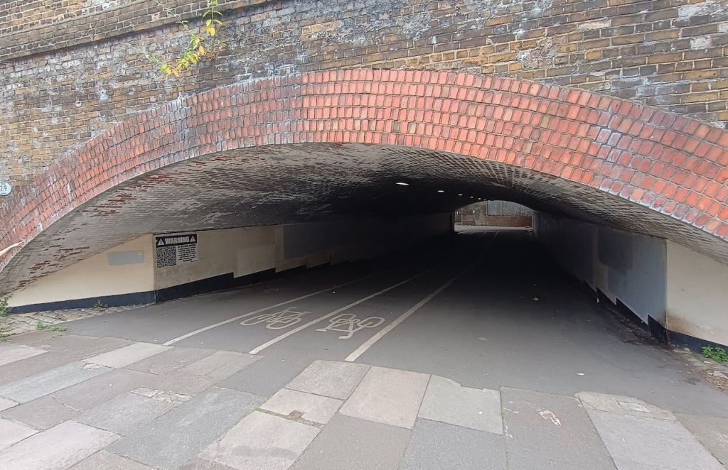
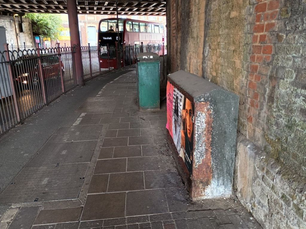
The Ravenet Street underpass – the one that ducks under the railways on the left just after the first bridge in the photo above – is proposed to be improved, given that it can offer an alternative and safer route for (say) young families to get to Battersea Park Road, avoiding the sharp bends and the traffic light junction. The plans are to introduce contrasting cycleway surface material and ‘entry treatments’ at Ravenet Street – which essentially means making the turn more obvious and safe for cycles.
However the Council’s report notes that it ‘has limited lighting’ and’ and that there is ‘a lack of wayfinding’. That’s maybe an understatement – this is really not a very attractive route, given that any cyclists heading through here get dropped in the Doddington estate’s car park areas without a clear route onwards. That, and the fact that the gloomy and little-used railway arch has a distinctly ominous feel to it, means we doubt this is really a workable alternative cycle route for anyone other than proper locals who know their way around the estate. However some effort will be made to improve the lighting and general look and feel of the underpass to make it more attractive, which will still be of benefit to residents on either side.
The bit of the road opposite the Loaf furniture shop will see a new light-controlled pedestrian crossing, roughly where the bus stops are – which makes a lot of sense as there is a long gap without any proper crossings here, and this really isn’t a safe place to cross the road at the moment (and almost everyone using the bus stops ends up having to cross the road one way or another). There are general plans for improvements to the look and feel of the street, and this bit of the road – a smelly, dusty thoroughfare that nevertheless has a load of flats facing directly on to it without much in the way of back gardens – could really do with some help. We were involved in the addition of four new street trees here some years ago, which have been welcome and made it just slightly nicer – but there’s a lot more that could be done to improve this bit of Wandsworth.
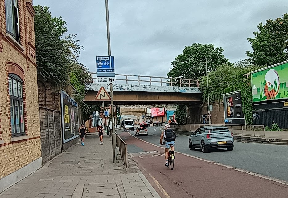
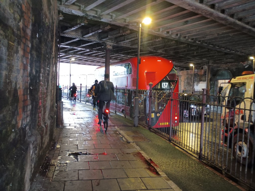
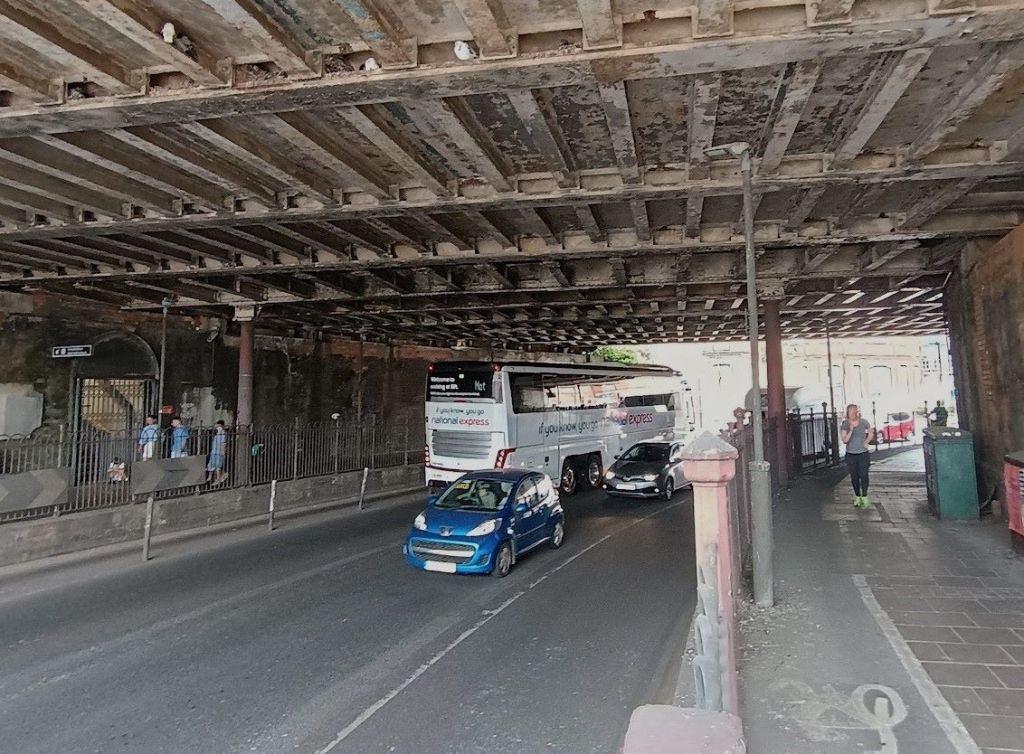
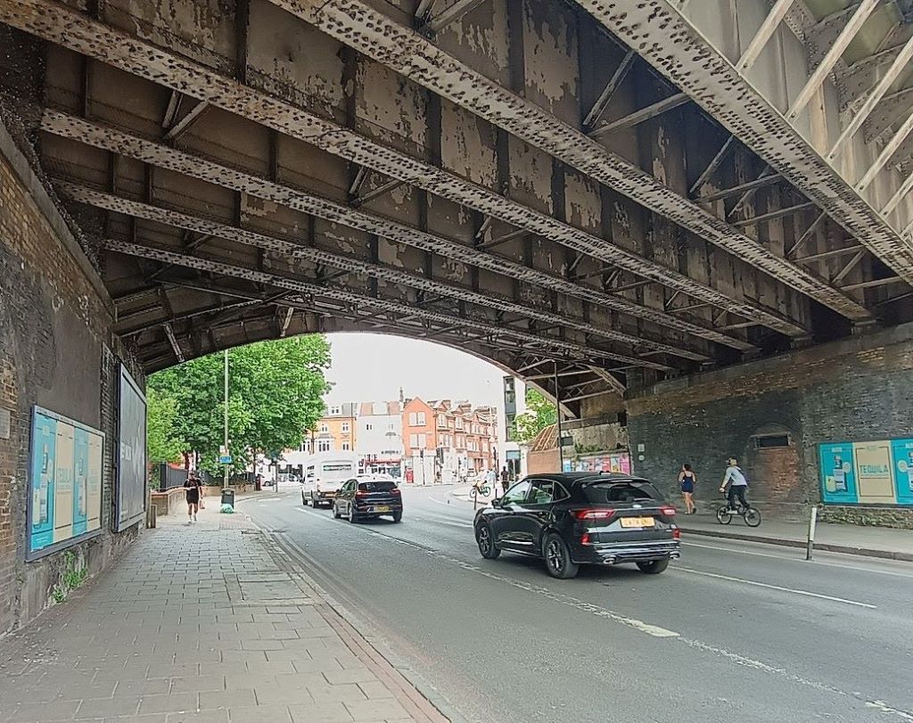
A really problematic feature of this part of Queenstown road is the sharp bends as the road passes under three separate railway bridges, including a particularly long and dark one running under the platforms at Queenstown Road Station. This is a dangerous bit of the road, that creates serious safety challenges. The sharp bend is also really hemmed in as the road surface has been dug down several feet to allow taller vehicles to fit through, and it’s all not helped by a high proportion of HGVs using this stretch of road (a fair few heading towards the industrial estates on Silverthorne Road, as well as some important coach routes). All this means many buses struggle to make use of the bus lane – having two traffic lanes as well as a bus lane just doesn’t fit on such a tight corner.
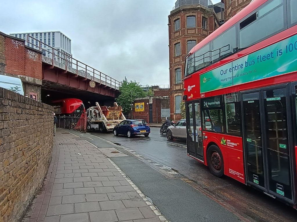
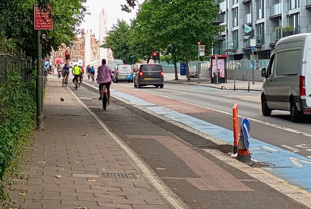
The bus lane on this bit of road does not work – the tight turning radius means you get stuck if you try and use it, if there’s any meaningful traffic in the area (which there usually is). Bus drivers have to deal with this mess day in day out, and they aren’t fools: analysis undertaken for the council last year found that a third of buses did not use the bus lane at all in the morning peak, 52% only manoeuvred into the bus lane after the bend, and only 3% used the full length of the bus lane. Interestingly they also found that the handful of buses that did stay in the bus lane had the longest average journey times!
The cycle situation here is also a mess – with a choice of working through a horrible tangle of vehicles busy changing lanes under the bridge, or a rather unusual bit of on-pavement cycle lane that tries to avoid the mess – but which isn’t actually wide enough for a typical bike, partly due to several lamp posts in the middle of it. A lot of cycles – even those usually quite happy to stay in the carriageway – clearly do not like this section of the road, given the high likelihood of being trapped in a pincer movement and crushed by a turning long vehicle. The Council’s measurement work confirms what we have seen, which is that the existing northbound cycle lane at pavement level is really quite well-used despite being nonstandard, with approximately 37% of cyclists in the morning peak using the lane at pavement level, and 63% using the bus lane. The Council also commented that many of those using the footway facility were children with parents.
Back in 2020 the Council had a go at making this known pinch point a bit safer and more cycle-friendly, using a Covid grant to roll out a temporary scheme where the bus lane was made 24-hours, a southbound cycle lane was added from Chelsea Bridge to Silverthorne road, and a series of ‘wands’ were added to stop vehicles parking in it. It was of course done on the cheap and wasn’t really a permanent fix – but it has worked fairly well, and the temporary cycle lane was later made permanent.
The plans are likely to further develop the approach that was taken back then, by completely removing the not-very-effective northbound bus lane between Silverthorne Road and Queenstown Road station – and using the space freed up on the road to create a ‘stepped’ cycle lane on each side of the road – i.e. one that is raised above the level of cars, to keep cyclists protected. It’s not clear whether the on-pavement one will also be kept in place.
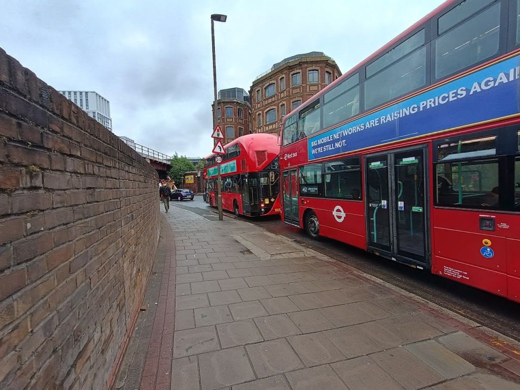
This isn’t a good bit of the road for pedestrians either, as the bridges are all in a pretty poor condition. The proposals suggest the Council will try and step in to improve these given their owner Network Rail clearly doesn’t care about them – with new feature lighting and art features introduced under the railway bridges (including Ravenet Street – which we have reported on before, in a previous phase of trying to upgrade that rather gloomy archway).
The middle of the three bridges, the one directly underneath Queenstown Road station, is particularly filthy, with no pigeon proofing at all, meaning walking through it is a bit of an obstacle course of dodging bird poo on the ground as well as that falling from above. The brick walls have a patchwork of decades of slime and mould on them, and the pavement seems to be wet a lot of the time. The northbound one is also somewhat blighted by a series of manky and foul-smelling utility cabinets, rusted after years of posters and urine. Unlike the other two, this bridge also has poor sight lines along the pavements, including some unhelpful alcoves just off the pavement on the eastern side, that can make it feel unsafe in the late evening.
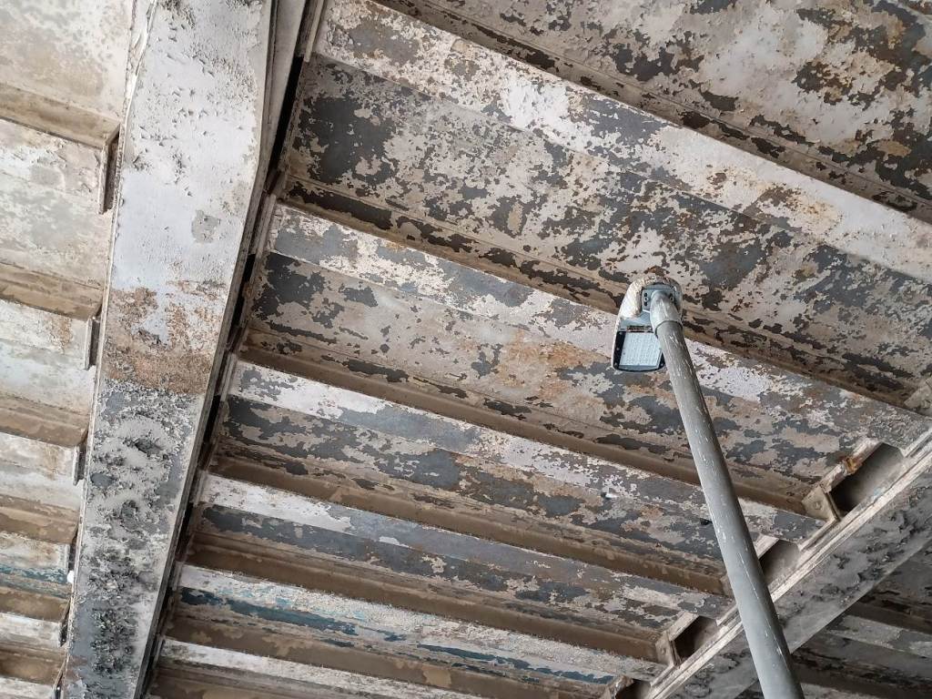
There aren’t any specific details on any plans to clean any of this up, but really things can only get better at this point – we’re hoping that the worst of it – the middle bridges – can be dealt with, at least in terms of a serious wash and durable pigeon proofing above the pedestrian and cycle routes – as it’s a very mediocre route as it stands.
Heading further north, things improve a bit – the final bridge could again do with painting, lighting and pigeon proofing, and the northbound cycle lane could do with extending.
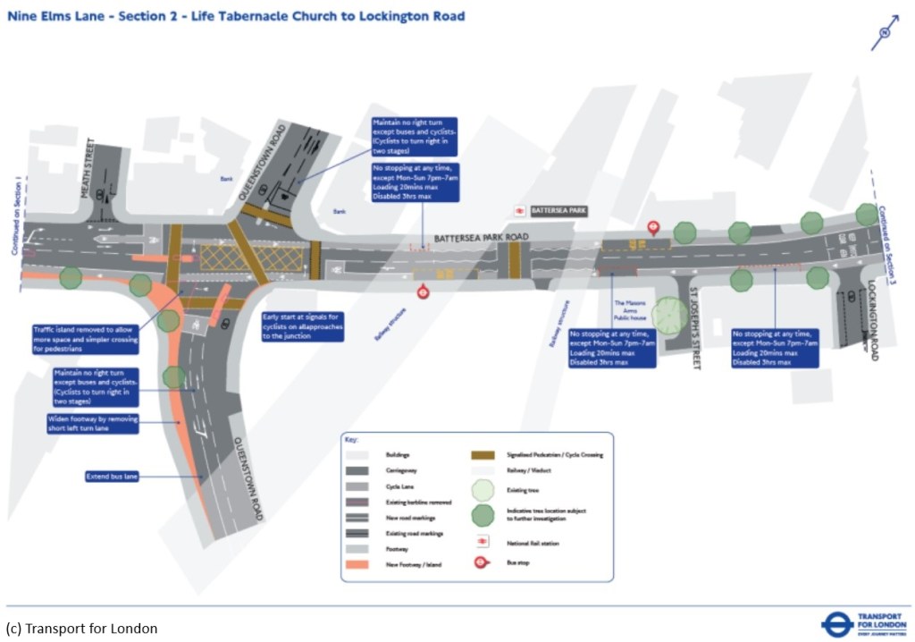
The hazardous junction with Battersea Park Road is set for an upgrade – with work led by TfL, who have been developing a scheme for Battersea Park Road as part of their Nine Elms corridor scheme, that will include this junction.
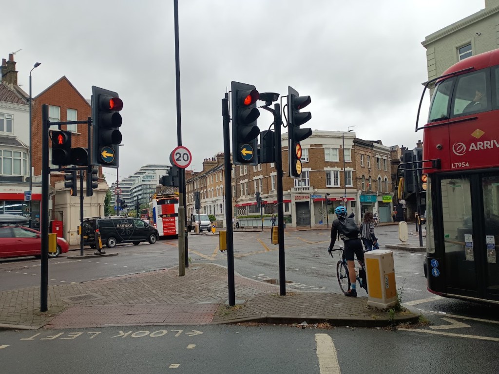
This means the mess in the photo above is likely to be replaced with something better able to handle the increasingly large flows of traffic here. TfL’s plans at the consultation stage included cycle lanes each way along Battersea Park Road, but made little reference to the desire for better cycle lanes along Queenstown Road. However they were developed many years ago and we’ll hopefully see further tweaks before anything is actually done here.
This junction is likely to be a long-term plan – as that part of the TfL project is both at a much earlier design stage than the rest of the TfL work on Nine Elms Lane (which is already underway, in areas nearer Vauxhall), and seems to be unfunded at the moment.
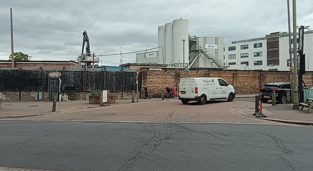
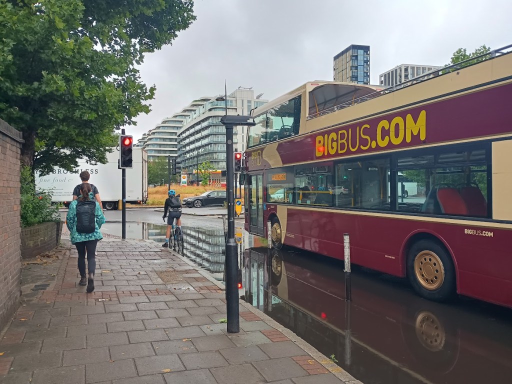
The final bit is the short and very busy bit of road between the junction and the roundabout. This is a mess at the moment – the main change is likely to be raising the level of the cycle lanes, so that they are properly separate from both the traffic lanes and the pavement. Both pavements are a bit too narrow for the amount of use they get, especially where there are bus stops, but there’s not really an easy way to fix that.
The next steps will see some sort of public consultation – probably one of the Commonplace online surveys, but with other consultation options also used – to get views and feedback from residents, businesses and road users, to make sure the plans are fit for purpose and deliver the overall aims of the project. Given a small part Queenstown Road is in Lambeth, there’s also going to be some comparing notes with Councillors on the Lambeth side of the borough boundary. This is likely to be later in the year, we’ll aim to keep our readers posted as this develops.
The other key question will also arise of how this will all be paid for. The changes on this part of the road have clearly been designed to be a fairly ‘bargain basement’ approach, because bluntly speaking there’s not a lot of enthusiasm for big spending in this area. It’s a slightly frustrating situation for those living in that corner of the Borough: a large pot of ‘Section 106’ cash was raised from developers over the last few years, in connection with the huge amount of new development in the area – and it was, back in the day, planned to go towards ‘local enhancements’ in the Nine Elms end of the Borough (specifically, the Vauxhall and Nine Elms Opportunity Area – which includes most but not all of the awkward bits of Queenstown Road) to better accommodate the impact of thousands upon thousands of new residents.
On the face of it that would have allowed a bundle of rather overdue works to go ahead – improving a lot of the areas around the Savona and Patmore estates and Carey Gardens, finally making progress on the much-delayed plans to bring step free access and safety improvements to Battersea Park station, and improving the horrible bridges and unsafe roads that are getting ever more crowded. Unfortunately, however, Nine Elms and the areas around it aren’t popular with the Labour administration – partly because the power station project is still seen as a project of the previous Conservative team – but mainly after the residents of Nine Elms elected Conservative councillors despite a high profile Labour campaign to win that area – so one of the first moves of the Council was to rip up the ringfence around that cash, and instead transfer it to wider and more electorally friendly parts of the Borough. This means projects here now have to battle with other priorities in Roehampton, Putney and Tooting – and that the funding available to provide for the huge local population growth in Nine Elms is a lot sparser.
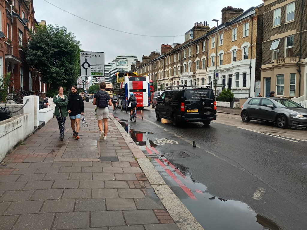
There is still a little bit of funding available – and northern section of Queenstown Road is already seeing some improvement works, which are due to be done by spring next year – though you could be forgiven for not having noticed! Our photo above pretty much shows the full extent of works so far, which have involved moving one of the kerbs by about a foot (though there have also been some underground utility works). The aim is to convert the current slightly odd situation where there’s an on-pavement cycle lane right next to an on-street lane if you’re travelling towards the river, and not very much at all if you’re going in the other direction, to instead have a cycle lane on each side. The works on the northern section are being funded from a combination of some of those now-Borough-wide funds made up of contributions received from developments in the Nine Elms Opportunity Area, and a grant from TfL. The Council notes that there’s no approved funding to continue works to include the southern section (and we know TfL isn’t exactly showering Boroughs with rats at the moment) – but they’ll aim to try and do something similar.
Overall this is a welcome development, and one that feels rather overdue. Queenstown Road has become a major commuter route, and some of it is not really working at the moment, whether you’re on a bus, riving, walking, or cycling. This should be a chance to deal with some of its most dangerous and unpleasant sections, to make it somewhere people are happy to live along – and to make sure that everyone using the road gets home safely at the end of the day. Hopefully this will also improve the street environment for the couple of dozen independent traders spread along the road close to its junction with Lavender Hill and give this somewhat neglected corner of Wandsworth a better sense of place. Keep an eye out for the consultation stages, and when the full details are published, we’d encourage those with an interest to respond and help this scheme move forward in the right direction.
Lavender-hill.uk is a community site covering retail, planning and development and local business issues, and sometimes posts like this one on transport, all centered on the Lavender Hill area in Battersea. We sometimes also post more detailed articles on local history.
If you found this interesting you may want to see our previous articles on smaller safety improvements to this bit of the road, our ongoing series of reports on improvements to Battersea Park and Queenstown Road stations, and on some of the office developments that are in the works along the middle bit of Queenstown Road – or to sign up to receive new posts (for free) by email – and if you have tips and leads to share, get in touch.

Knowing that road extremely well, having taken my child to school at Newton Prep from Clapham Junction for many years, it’s great to see the wider realisation of how poorly the whole thing works. I wonder if the planners have observed the extremely dangerous tendency of cyclists to move onto the pavement at great speed, just before the sofa shop – before the marked cycle lane begins – without calculating for pedestrians getting off the bus at the stop there. Pedestrians thus step directly into the path of the peloton, and neither the cyclists nor the passengers are expecting to encouter the other.
And the Ravenat underpass is just unusable, even for those who know the estate. It all needs more than a budget solution.
LikeLike
Hi Susanna, as a twice-weekly bike commuter along this stretch, I completely agree with your observation of cyclists moving onto the pavement too early and not taking enough care. I have always made the effort (not much effort) to only join that cycle lane at the correct place, even if that means waiting behind a bus and/or waiting in the inevitable traffic. In fairness, it’s annoying to be stuck behind a bus and stuck in traffic at that point, when cycling is supposed to be encouraged as a mode of transport, so I can understand (even if I don’t agree with) why some cyclists decide to use the pavement too early. But some mornings it seems that a majority of cyclists use the pavement, and so many of them clearly don’t have any regard whatsoever for pedestrian safety as you point out. On my 20km commute from Croydon to Soho, the section from here to Queen’s Circus is probably the most stressful bit, and that’s saying something. A redesign is incredibly long overdue.
LikeLike
Pingback: Queenstown Road’s most special tree gains protected status | Lavender-Hill.uk : Supporting Lavender Hill
Pingback: In pictures: The Shelf, a new approach to retail, opens on Lavender Hill | Lavender-Hill.uk : Supporting Lavender Hill
Pingback: Clapham Junction’s Rough Sleepers Hub opens for business | Lavender-Hill.uk : Supporting Lavender Hill
Pingback: Antrim House may be about to gain a bundle of phone masts | Lavender-Hill.uk : Supporting Lavender Hill
Pingback: Six new houses may be on the way to a well-hidden part of Queenstown Road | Lavender-Hill.uk : Supporting Lavender Hill