
Falcon Lane doesn’t really feel like the rest of Clapham Junction. Rather than dense Victorian streets, it has more of an “out-of-town retail park” vibe, with car parks and single storey warehouse buildings. The buildings that house Asda, Lidl, and Boots were developed in the late 1980s, and although the occupants have changed (Asda was previously a Gateway and Boots was Pets at Home), the buildings haven’t really seen much change since.
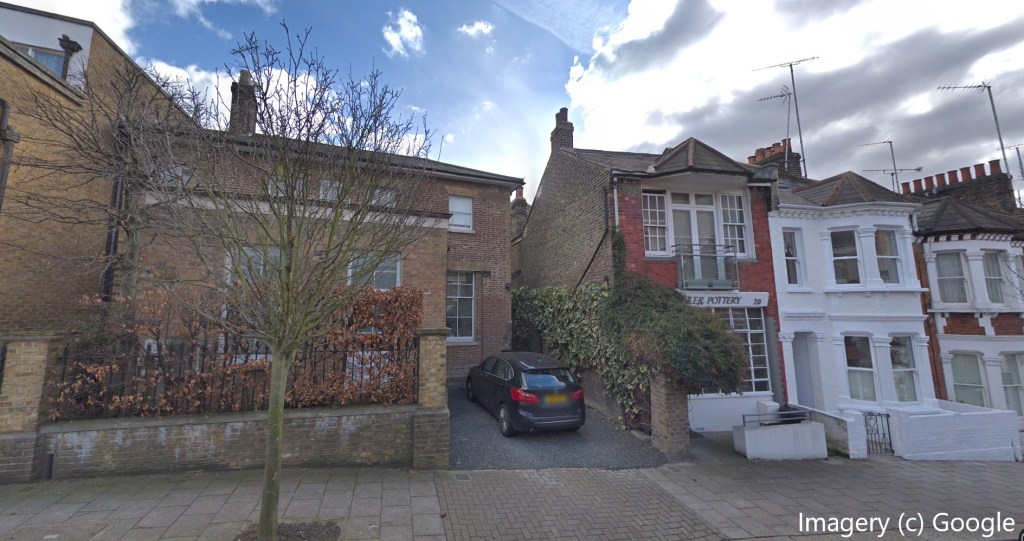
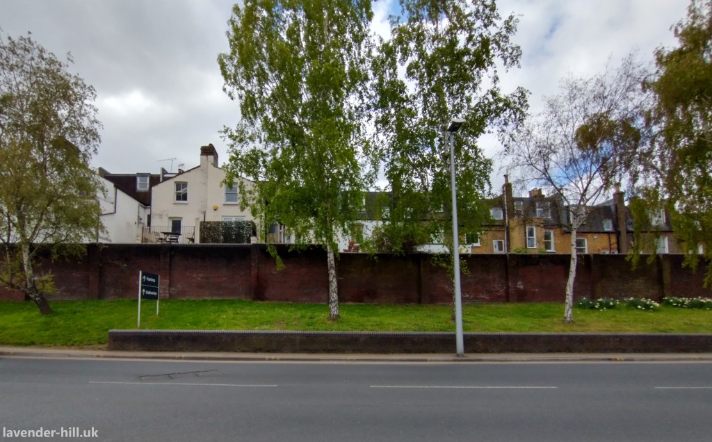
Their low density and surface car parking is quite a contrast to everything around them. And regular readers will know that whenever we talk about low density, it’s almost always because there’s some giant redevelopment proposal about to land! But before we get to the future, it’s worth a detour to the past – because this whole area has a complicated history. The land was originally the grounds of a large country villa called Abingdon Lodge – whose gardens were described as “among the best cultivated and most fruitful’ in the vicinity”. A second smaller one was later added in the garden of the lodge, called The Chestnuts. But as the railways arrived the large villas on Lavender Hill were gradually sold and demolished and replaced with dense terraced housing and industry, and Abingdon Lodge was converted in to one of the very many railway sidings in inner London. And this is where the first of a few surprises: the second villa, The Chestnuts, somehow managed to avoid being knocked down like all the other old villas. Instead got scooped up in the streets layout of the Victorian terraces that were built on its gardens – presumably because the builders thought it would be a shame to demolish it if it could just about be kept running – and it’s still standing today. It’s visible as a house with a different design to its neighbours half way along Mossbury Road (shown below), which is at a slightly strange angle to the rest of the street, and which has a completely different and earlier, less ornate architecture. Even if its one-luxurious gardens have long gone, it’s still possible to get a sense for what it would once have been, proudly standing on the side of the hill with sweeping views north towards the Thames, south towards Clapham Common, and west to the Falcon river.
But back to that railway siding. Clapham Junction has a lot of railways now, but we tend to forget that back in the day there were also railway sidings all over the area, (including much of Nine Elms and Queenstown Road) as they had been built when land was cheap as chips and Battersea was littered with industries who needed them.
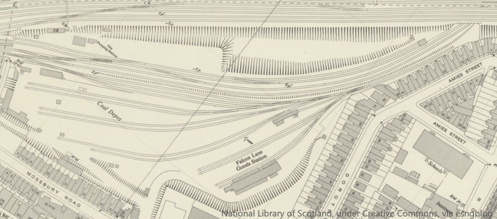
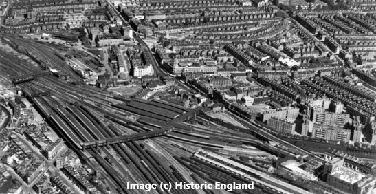
The map above shows the layout of the Clapham Coal depot and the now-forgotten Falcon Lane Goods Station – despite Falcon Lane as we now know it not yet existing. There was also a three storey set of administrative offices built in 1909, which are just about visible at the top left hand corner of the aerial photo to the right, taken in 1948.
Demand for coal depots like this one went in to steep decline by the 1960s (not least because the 1956 Clean Air Act paved the way for a lot of households to stop using coal), and the depot was put up as a redeing down in 1968. The initial plans were for it to be quietly developed in to a housing estate (though a complicated lease on part fo the land to a bottling company meant nothing happened quickly).
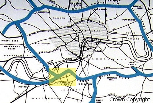
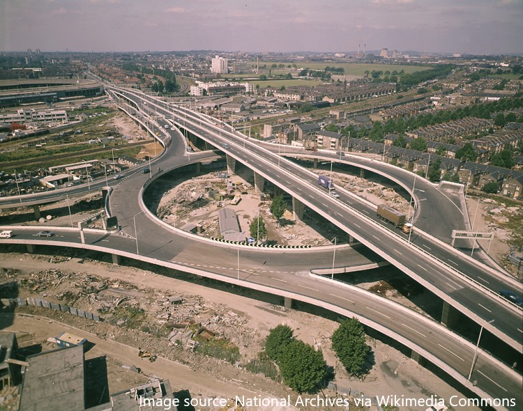
But these were the crazy days of the late 1960s, and this site – much of which was still owned by British Rail – instead became the planned location for a gigantic motorway interchange, which would have occupied 55 acres of land around the station! The overall motorway plan – for what would be known as Ringway 1 – is shown to the right. One new motorway would have run from White City to Shepherds Bush, before crossing the river on a new bridge next to the Battersea railway bridge, and carrying on down parallel to the railway, ploughing through Fred Wells Gardens and Falcon park before splitting in to one motorway running through the northern edge of the Shaftesbury Estate to Brixton, and another curving round to a spectacular elevated junction perched over Latchmere Road and Falcon Road, with a motorway running west on its way to carve through the Old York Road in Wandsworth (actually running above some of the platforms at Clapham Junction on the way) and another jumping over St John’s Hill and running south across the Wandsworth Common towards Balham.
The image below (which is borrowed from the well-worth-a-look page on this abandoned scheme at roads.org.uk) shows what could have been built on the Falcon Lane site, in all its four-level 20-lane glory.
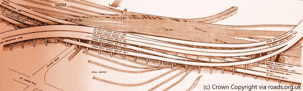
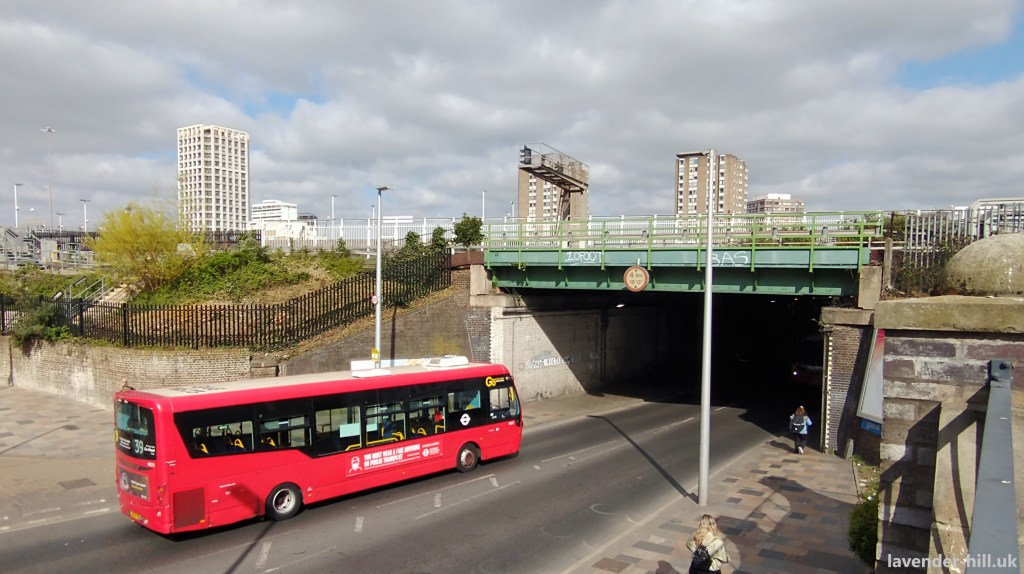
The Falcon Road bridge, towards the left hand side of the illustration above and shown below as it is now, would have seen a whole series of motorways running above it, to an impressive height given the need for even the lowest levels of the interchange to run above the railway tracks.
Had these plans gone ahead, they would have condemned most Clapham Junction to forever be a bedraggled set of buildings cowering under a giant set of flyovers, with some new buildings along the sides of the roads as a sound barrier – and we’d hazard a guess the place would look very different indeed.
And they very, very nearly did go ahead! Because this wasn’t some long term vision but rather a very real building programme, and the northern half of this motorway was built – which explains the mysterious dead-end ‘motorway‘ that runs south from White City before suddenly stopping in Shepherds Bush – the image below shows the construction at the northern end in the late 1960s, including the northern ‘exit’ from the roundabout that still points directly at a terraced house! Quite a lot of property further south was also bought and demolished in preparation for the works, before the whole scheme mercifully ground to a halt, leaving Shepherds Bush with the joy of a motorway pouring traffic in to a residential area, and a series of rather blighted properties along the whole of the rest of the route.
This potentially catastrophic plan did have one local upside: it alerted the residents of Battersea to the need to defend and reinvigorate the area, which was increasingly struggling as its traditional industries faded or moved out of central London, and looked like a target for redevelopment. This was a key moment for the Battersea Society – which led successful campaigns to protect the history of Battersea, such as preventing the redevelopment of Battersea Square and High street. By the time the motorway plans reached a public inquiry in 1970, the society found itself among were more than 100 pressure groups across London fighting the motorway. Maybe more surprisingly, five councils who weren’t known for their cooperation – Lambeth, Lewisham, Merton, Southwark and Wandsworth – joined forces to fight the motorway plan, given the huge destruction it would cause. In 1973, following a change of control at the Greater London Council, the increasingly untenable Ringway motorway project was killed off.
Meanwhile the Falcon Lane goods station was in an increasingly sorry state – being completely derelict, and with the motorway plans having delayed any redevelopment for over a decade. Wandsworth Council had been trying to get control of the site, and in 1976, released a grand plan to develop both the station approach itself and the goods yard as one big project – using most of the goods yard land for light industry, with shops and offices on a deck above Clapham Junction station. British Land was expected to build the office & retail part of the scheme, having bought most of the plots around the station.
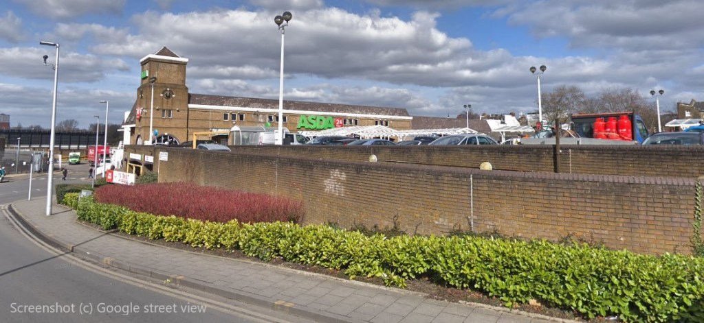
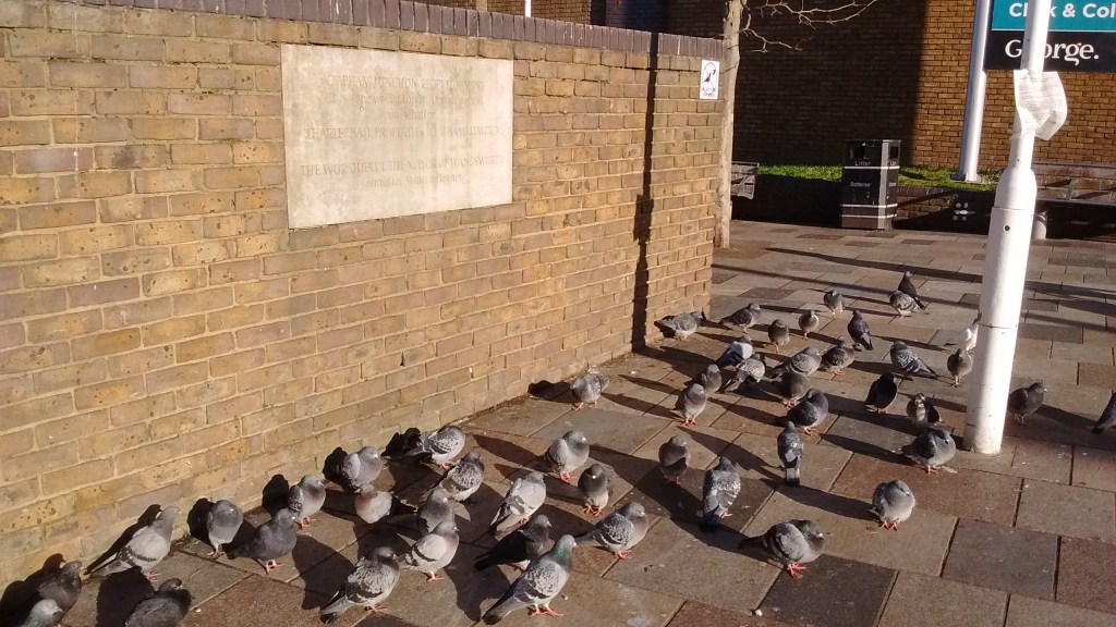
This plan never really came to fruition, because no one party was ever able to get hold of all the land – and in 1985 British Land sold their parts of the land to a firm called ‘Compact Retail Developments’ which led to the development of what’s now the PCS office building on Falcon Lane and the small ShopStop indoor shopping centre at the station. Another firm called Charterhall Properties developed the old goods station in to what we see now, including Asda, Boots and Lidl buildings, as well as building Falcon Lane as we now know it. There’s still a plaque by the way in to Asda – pictured below, with its seemingly ever-present fan club of pigeons – celebrating the redevelopment.
At least the site was now in productive use, with a working station and space for large modern retail – which was an improvement on what went before. But frankly the whole place hasn’t aged well – despite only opening in the late 1980s, it all looks pretty tired and it’s not surprising that there have been various parties interested in redeveloping parts or all of the site in recent years.
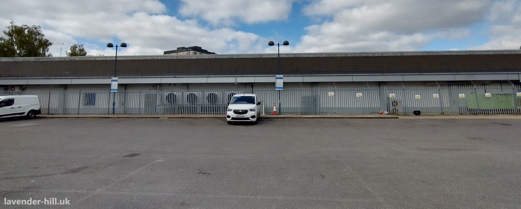
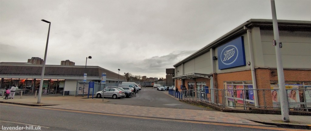
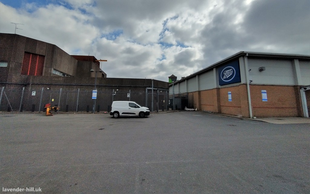
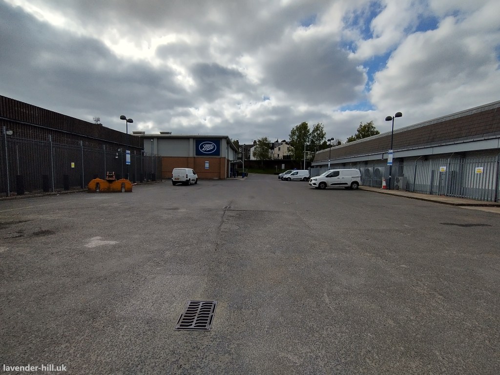
The current layout of Falcon Lane (pictured below) is very much optimised for vehicle access, with wide roads and unusually narrow pavements – and it makes sense for a set of big retail units with car parks. But to make the most of the site for a wider set of uses ideally needs a coordinated approach, that might see a change to the alignment of the road to turn it in to a more traditional urban ‘road’ with buildings on each side.
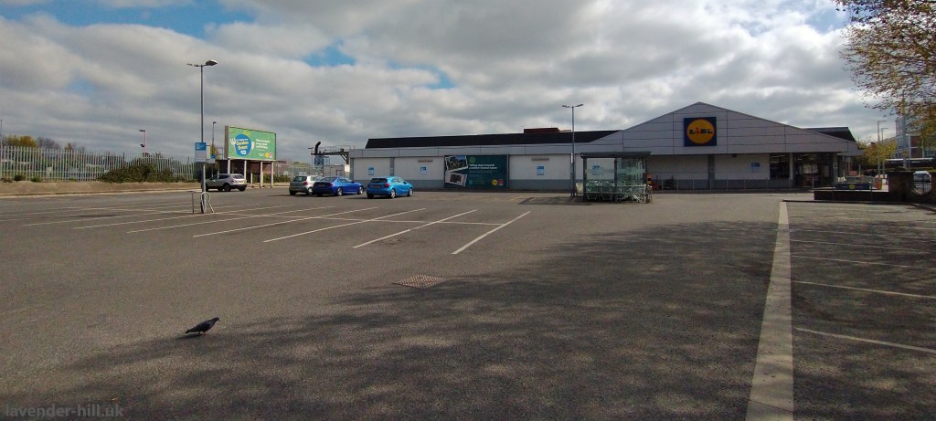
Unfortunately the three big sites are all in different hands, and each of them has their own vision for what they want to do. Lidl have had some big plans to rebuild their store, which we and Clapham Junction Action Group covered in some detail – but have ended up with a relatively minor extension to keep it going for another decade or so.
Asda have recently invested in a refurbishment of the store to deal with the most immediate problems (which included a very leaky roof and a somewhat shoddy building that was starting to really show its age), but realistically now that they have seen a change of ownership they are likely to go for a bigger development sooner or later.


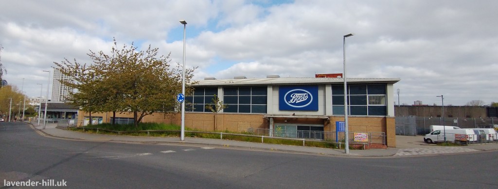
Boots is maybe the most likely to see action in the near term. It occupies an oddly shaped site pictured to the right – which was put up for sale for offers over £8.7m back in 2018. Boots has a 25-year lease from 1999, which runs up to 6th May 2024 (and at the time of the sale they were paying £370,000 rent per annum subject to five yearly upwards-only rent reviews).
The site was clearly being sold with a view to redevelopment! Before the sale, some plans were sketched out for a development of the site as part of a feasibility study – with one pictured to the right, which would see a curved block of flats, with the car park being to some extent retained. It’s a distinctly odd shaped plot of land, and not the easiest to build something else on. Awkwardly there’s also a right of way running right through the middle of the Boots car park, which gives access to the railway lands behind, so any new development will need to preserve this or something similar.
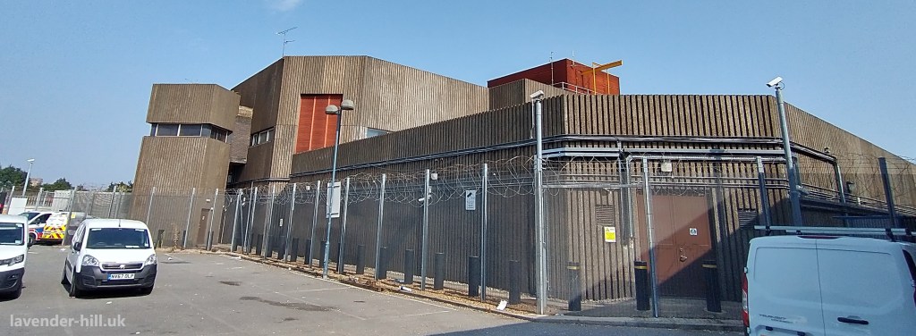
And there’s another complication! Because while we’ve talked mostly about the big three retailers on this land, there’s another big tenant on the old goods yard site. Lurking at the back of Boots, and one of the reasons the Boots plot is such an odd shape, is a mysterious brown concrete building, with very few windows and no obvious identification. The only thing the casual passer by will notice is that this building is built to be as tough as possible, seemingly to withstand a small scale explosion – and that it’s very heavily protected. Security cameras, razor wire, thick fencing, double security gates, anti-ram-raid bollards, ominous warning signs making it clear that this is not somewhere you want to linger.
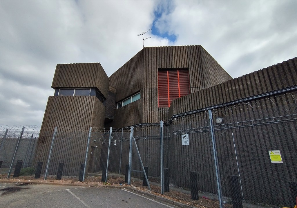
This is the Victoria Area Signalling Centre – and it was built at about the same time as the rest of the development in 1980, controlling the railway signals for much of south London. It’s a pretty strategically very important building: without it rail services would immediately grind to a halt – hence the protection.
However this isn’t set to remain the main signal centre for all that long. The control centre was built in 1980, with some modernisation in 1992 – but it’s been rather overtaken by new technology, an Network Rail are now part-way through a huge £160 million programme of work to completely replace the signal system running out from Victoria Station. This will see signalling control of the area moving from the Victoria Area Signalling Centre to a new state-of-the-art ‘Rail Operating Centre‘ at Three Bridges near Crawley, which will take over control not just of the south London operations, but of most of the railways in south east England. It’s bad news if you’re a signaller working in Clapham Junction, with several hundred jobs set to be relocated to Crawley – but it should be good news if you’re a rail user with a much newer (and, hopefully, more reliable) signal system in place.
The signalling work should be all complete by 2025, which leaves the future of the signalling centre at Clapham Junction looking pretty bleak: with no signalling work to do it’s likely to be up for redevelopment. That 2025 date does sound rather close to the end of Boots’ lease on that site next door, in 2024.
And as we noted earlier – the Boots site was put up for sale, and at the end of 2018 it was bought by none other than Network Rail, for £11.75m. This could mean various things – the most obvious being that when they do finally close the Clapham Junction signal centre, owning the Boots site as well gives them a much bigger and more sensibly shaped piece of land to redevelop for other uses (whether they do this themselves, or sell it to someone else as a development site).
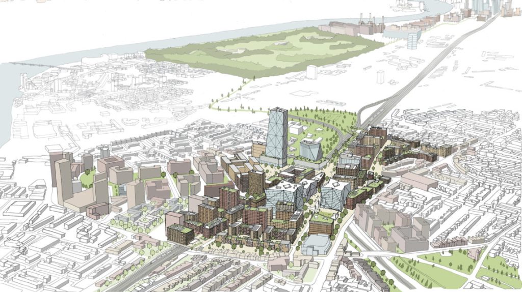
This could also be a way to have access to a site compound / staging area for the longer-term plans we have previously written about to redevelop Clapham Junction station – which has some echoes of the 1976 British Land plan we mentioned previously to build offices and shops above some of the platforms. That is set to be a big job, and it will be a lot easier and cheaper to do with a worksite nearby. It’s probably fair to say that those plans have moved to the right – due to a combination of reduced passenger demand across the board, a more difficult investment environment for Network Rail following the substantial costs it has faced during the pandemic, and maybe above all a current government which is mainly focussed on ‘levelling up’ in marginal constituencies in the North and wary of anything that looks like investment focussed in London. Changes to the way government investment projects are assessed, to focus investment further north and give more control to Ministers and less to economists, will also make the project more difficult to deliver: as far as we are aware the business case that was due to go in early last year for the station upgrade was never submitted, and realistically it’s likely to need to wait until the political landscape shifts to go ahead.
However the underlying case for significant investment at the station remains pretty compelling – partly because there’s plenty of scope for commercial income as part of any redevelopment, but also because the current station layout is increasingly acting as a bottleneck for rail services across the whole of the south east, which means the need for some sort of upgrade is likely to become unavoidable. Network Rail aren’t in any particular hurry to confirm what they plan to do with the Boots site, but it’s fair to say that in 2025 the future of Boots on Falcon Lane – whether a small block of flats, a railways worksite, or the first part of a bigger development – will be giving us a big hint as to the future of Clapham Junction as a whole. It’ll be the latest in an unusually long and varied set of uses & proposals for this piece of land, from luxury Victorian Villa to railway yard, storage depot, motorway junction, undeveloped housing estate, to railway control centre and supermarket centre – and as ever, we’ll keep you posted on the next steps…

I hope the cherry tree will be protected and preserved.
LikeLike
An Excellent report very informative. Many thanks for sending it.
LikeLike
Pingback: Network Rail, re-signalling project and Boots site in Clapham Junction | Clapham Junction Action Group
Pingback: Network Rail, re-signalling project and Boots site in Clapham Junction – CJAG News
Pingback: Shapurji Saklavata, Battersea’s controversial one-of-a-kind MP in the 1920s, will be recognised with a plaque this Friday | Lavender-Hill.uk : Supporting Lavender Hill